Info
District: Tulkarm
Population 1948: 1470
Occupation date: 13/05/1948
Occupying unit: Alexandroni brigade
Jewish settlements on village/town land before 1948: Kfar Saba
Jewish settlements on village/town land after 1948: Kfar Saba East Neighborhoods (Kaplan), Givat Eshkol, Hadarim, Neve Hadarim, Bait Vanof, Ganei Hasharon, Geulim, Industry Area, Neve Yamin
Background:
Kafr Saba was located on a flat coastal plain 1.5 km east of the Haifa-Lydda railway and the Qalqilya border. The village dates back to the Roman period when it was known as Caphar Saba and later identified as Kapharseb during the Crusader period.
Arab and Muslim geographers such as Al-Maqdisi, writing in A.D. 985, described it as a large village with a mosque that was situated on the road to Damascus. Nasir Khrusraw (A.D. 1047) described its rich fig and olive trees that lay along the road to al-Ramla.
The village cultivated grain, watermelons, cucumbers, and vegetables. In 1730 al-Luqaymi attests to the continued existence of the village after he visited the shrine of a local religious figure, Binyamin (al-Nabi Yamin).
In the nineteenth century, Kafr Saba’s population was estimated at 800. The village contained a mosque and was surrounded by sandy ground with olive groves to the north, springs to the east and northwest, one of which provided the village with drinking water. The village expanded under the British Mandate period.
The residents were Muslims and maintained two religious shrines; the al-Nabi Yamin and al-Nabi Yahya (John the Baptist). The village had one elementary school.
Occupation and Depopulation
Kafr Saba was situated North of Tel Aviv in an area of heavy Jewish settlement. The New York times reported that leaders from Kafr Saba met with Jewish community leaders as early as December 1947 and agreed to keep the peace.
However Arab Liberation Army (ALA) commander Fawzi al-Qawuqji describes a “surprise” assault on 10 May, which caused panic amongst the people of Kafr Saba. on 13 May, Qawuqji recorded a second attack along the north-south axis from Tulkarm to Kafr Saba, which saw heavy Haganah losses early on and continued fighting. It was after the second attack that villagers fled to Qalqqiya, which in turn led to the temporary evacuation of that town.
Israeli Settlements:
The Jewish town of Kefar Sava lies just southwest of Kfar Saba and was founded in 1903. In 1948 the population stood at 5,000 and today it has risen to about 45,000. Beyt Berl was established in 1947 on village lands to the northwest of the site. Newe Yamin, named after al-Nabi Yamin, was established in 1949 and lies to the east of the village site near his shrine. 1km northeast lays the settlement of Nir Eliyyahu, established in 1950 on the lands of nearby Qalqilya.
The Village Today
Today the village site is used for the construction of new residential quarters within an industrial area that is a part of the settlement of Kefar Sava.
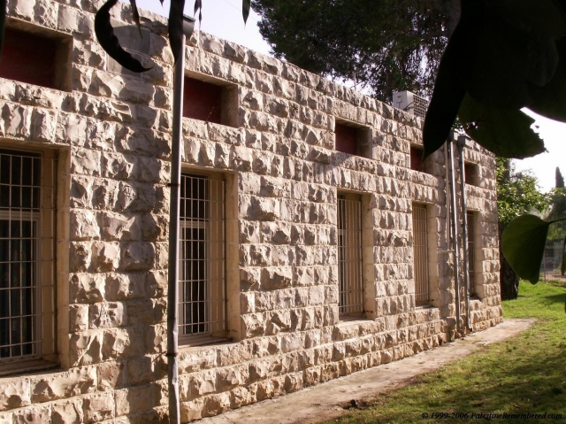
The domed shrines and their arched entrances have survived destruction along with the school, and the ruins of the village cemetery. Some of the old village houses within the settlement have also been converted to commercial buildings. The land around the site is cultivated by Israelis.
--------------------------
Source: al-Khalidi, Walid (ed.). All that remains: the Palestinian villages occupied and depopulated by Israel in 1948. Washington DC: 1992.


