Info
District: Safed
Population 1948: 1880
Occupation date: 31/10/1948
Occupying unit: Carmeli brigade
Jewish settlements on village/town land before 1948: Misgav Am
Jewish settlements on village/town land after 1948: None
Background:
Hunin Before 1948
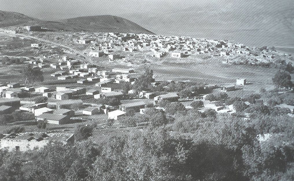
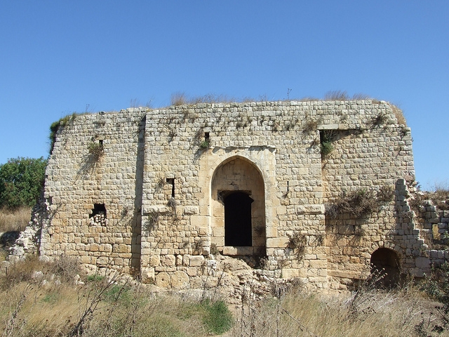
Plain. Hunin was Very close to the Lebanese border and was part of Lebanon until 1923, when the Lebanese-Palestinian border was delineated by Britain and France. It had two springs and a reservoir on the southwestern edge of the she. The Crusaders built the castle of Chastel Neuf at Hunin in 1179. The Arab traveler lbn Jubayr, who passed through the area in about 1183, described it as a fortress which still belonged to the Franks. The defenders of the castle surrendered to Salah al-Din al-Ayyubi (Saladin) toward the end of 1187. However, the Crusaders reoccupied it in 1240, and were driven out for the last time by the Mamluk sultan Baybars in 1266. Yaqut al-Haniawi(d. 1228) mentioned Hunin as a village in the mountains of ‘Amila (Mount ‘Amil) overlooking al-Hula. The site was also described by al-Dimashqi (d. 1327) as “the castle of Hunin” which, he said, was an administrative center with villages under its jurisdiction In the late nineteenth century, travelers described Hunin as a stone-built village joined to a ruined Crusaders’ castle. The village, which stood on a low ridge, had about 100 (predominantly Muslim) residents. Although the hills surrounding the village were uncultivated, there was farmland in the valleys below it. Hunin had a mosque and an elementary school for boys. Agriculture was the mainstay of its economy; in the 1944/45 season a total of 5,987 dunums was allocated to cereals and 859 dunums were irrigated or used for orchards.
Occupation and Depopulation
Like almost all of the villages in the Galilee panhandle, Humn was occupied in the course of Operation Yiftach (see Abil al-Qamh, Safad District), which was implemented in April—May 1948. An Israeli military intelligence report later stated that Hunin was evacuated by its residents on 3 May. By that time, Zionist forces had not yet reached the village and a Palmach report claimed that Arab forces ordered the villagers of Hunin to leave by 14 May. These reports are not consistent with the recollections of eyewitnesses interviewed twenty-five years later. People from the nearby village of al-Khalisa (2.5 km to the southeast) recalled that, on the morning that Safari fell (11 May), they decided to evacuate women and children to Hunin. When al-Khalisa was captured a few days later, its village militia also retreated temporarily to 1-lunin. Al-Khalisa’s militia probably moved on to Lebanon a few days later, along with the people of Hunin itself.
While discrepancies exist regarding the timing of this evacuation, there is broad agreement on the general picture. The commander of Operation Yiftach, Palmach chief Yigal Allon, wrote later: “We regarded it as imperative to cleanse the interior of the Galilee and create Jewish territorial continuity in the whole of Upper Galilee.” This was achieved partly by direct attack and partly by using a campaign of psychological warfare.
Israeli Settlements on Village Lands
The settlement of Misgav ‘Am was established in 1945 on the northern part of the village lands. Jewish immigrants from Iraq and Yemen established the settlement of Margaliyyot on village land in 1951, just south of the village site.
The Village Today
The vicinity are the cemetery, the elementary school, and castle built by the Crusaders remain. The castle is a tourist attraction, and the school is used by Israelis as an agricultural warehouse. The lands in cultivated by the settlers.
-----------------------------------
Source: al-Khalidi, Walid (ed.). All that remains: the Palestinian villages occupied and depopulated by Israel in 1948. Washington DC: 1992.


